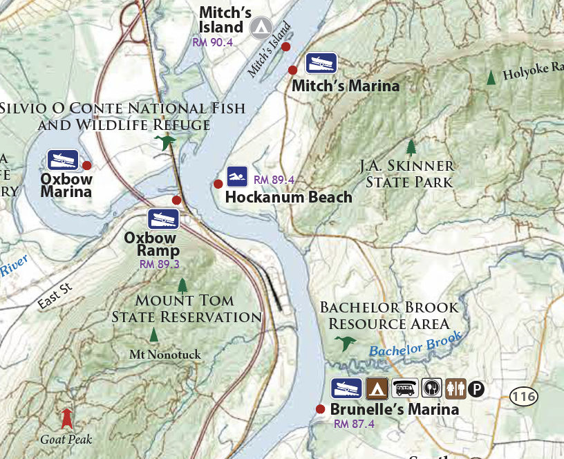
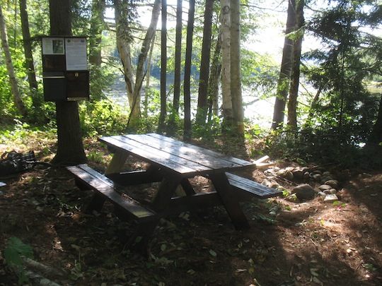
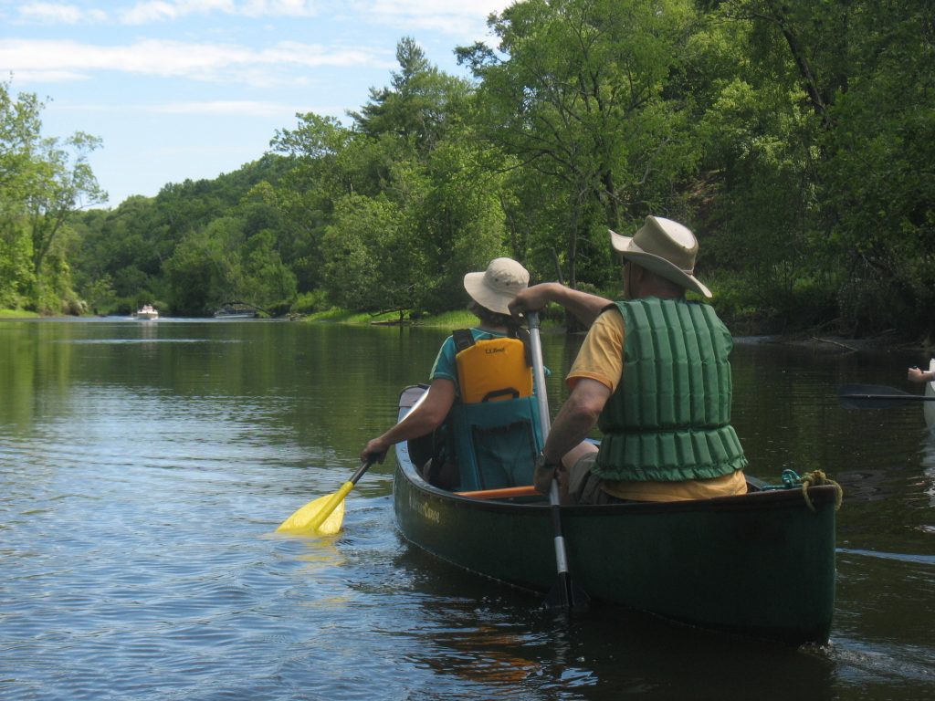
The following is a list of campsites from the Connecticut River's Headwaters south to the Massachusetts border. Click on the name of the campsite to learn more and to view it on a map.
Campsite River Mile Site Description Site Steward Maximum Group Size Site Status
Deer Mountain Campground 409 Drive-in access from Route 3. Just south of the Canadian border, this 25-site primitive campground is located in Connecticut Lakes State Forest. New Hampshire Division of Parks and Recreation Suitable for Large Groups Open
Lake Francis State Park 387.5 Drive-in access from Route 3. In the Great North Woods this lakefront park offers 45 sites for tent camping as well as some two-way hookups. The park offers excellent base for fishing, wildlife viewing and kayaking. New Hampshire Division of Parks and Recreation Suitable for Large Groups Open
Holbrook Point 361.1 Holbrook Point is a beautiful campsite situated under a canopy of silver maples on the edge of a floodplain forest. It is situated at a bend in the river, about 1.3 miles south of the Colebrook Bridge. Vermont River Conservancy 12 Campers Open
Columbia Campsite 359.3 Simple campsite on edge of field Columbia Conservation Commission 12 Campers Open
Lyman Falls State Park 350.6 Several campsites below breached dam. River and foot access only. State of Vermont Department of Forests, Parks, and Recreation Suitable for Large Groups Open
Belknap Campsite 347.7 Small campsite, accessable by paddling or lining a boat slightly upstream on the Nulhegan River, just past the Rt 102 bridge. Foot access possible on a short trail behind a Northern Forest Canoe Trail kiosk. Campsite situated on the river's north shore. State of Vermont Department of Forests, Parks, and Recreation Small Groups - Room for Three Tents Open
Maine Central Railroad Trestle 340.8 Beautiful campsite maintained by the Northern Forest Canoe Trail, conserved through the efforts of Bruce and Mary Sloat. The site is immediately downstream of granite railroad trestle, on the Vermont side. Northern Forest Canoe Trail 12 Campers, 3 Tents Open
Samuel Benton Campsite 333.9 The campsite is situated in a grove of trees on a sandy bluff, at the edge of a field, on privately owned farmland. Northern Forest Canoe Trail 12 Campers, 3 Tents Open
Scott C. Devlin Memorial Campsite 324.3 Situated in a shady stand of pines about two miles below the confluence of the Upper Ammonusooc, after the river makes a tight 180 degree turn near 102. Vermont River Conservancy 12 Open
South Guildhall Campsite 317.4 Beautiful campsite situated in floodplain forest, with great views of the White Mountains. Vermont River Conservancy 12 Campers, 3 Tents Closed for the season
Beaver Trails Campground 313.2 Private riverside campground. Caters to RVs, but grassy meadow provided for tent camping. For reservations and info call 888-788-3815 or visit www.beavertrailsnh.com Beaver Trails Campground Large Groups Closed for the season
Gilman Dam Portage Campsite 301.7 Camping allowed in grassy field along portage trai. No amenities. Ampersand Energy LLC Suitable for Large Groups Open
Dalton Primitive Campsite 298.8

Located just north of high tension line that crosses the narrow, north arm of the reservoir, on the New Hampshire side.

TransCanada Hydro Northeast Large Groups Open
Moore Primitive Campsite 289.9 Recently established campsite for paddlers only. Features include five tent platforms, picnic tables, and fire rings TransCanada Hydro Northeast Large Groups - 5 Tents Open
Stevenson Campsite 280.2 Located on a shady river terrace on the New Hampshire side of the river, across from the north end of Stevens Island. Vermont River Conservancy 3 tents Open
Fiddlehead Island 273.5 Third wooded island in reach, north of Dodge Falls Vermont River Conservancy 12 Closed for the season
Dodge Falls Campground 272.4 Small campsite at the portage of Ryegate Dam, about .5 miles north of Dodge Falls. Dodge Falls Associates, LP 8 Open
Howard Island Campsite 265 In Haverhill, about 2 miles below the Woodsville Bridge. The northern campsite is located at the northeast end of this island with access on a moderately-sloped cobblestone bank. The southern campsite is at the southwestern corner of the island. Upper Valley Land Trust Large Groups Open
Harkdale Farm Campsite 259 Access on Vermont side at second large oxbow downstream of Howard Island, across from high eroding sand bank that meets small brook with fallen trees. Upper Valley Land Trust 12 Open
Vaughan Meadow Campsite 253.2 Located on the Vermont side one mile below the old Bedell Bridge abutment. Located on a wooded bank after the river turns from SE to S, a few hundred yards north of the Bradford line. Upper Valley Land Trust 12 Open
Underhill Campsite 245.6 Past Bug's Island. Located at the mouth of Eastman Brook, before the river veers west. Piermont Conservation Commission 12 Open
Pastures Campground 239.5 Private campground with hot showers, dishwashing facilities, w-fi, and more. Learn more at www.thepastures.com. The Pastures Campground Large Groups Closed for the season
Birch Meadow Campsite 237.8 Two miles below the arch bridge, on a low wooded point just above the marshland at the outlet of Lake Morey. Upper Valley Land Trust 12 Open
Roaring Brook Campsite 235.3 Grassy site between two brooks. The stairs were lost in the October 2010 floods. The take out has been moved to the upstream brook to prevent further bank erosion on the downstream banks. Upper Valley Land Trust 12 Open
Gilman Island 220.4 Group campsite managed by Darmouth College's Ledyard Canoe Club, on land provided by TransCanada Hydro Northeast. Ledyard Canoe Club Two Sites, 10 Campers each Open
Burnaps Island Campsite 212.1 Located about 3 miles below the mouth of the Mascoma River and the I-89 bridge at West Lebanon, and just above the mouth of the Ottauquechee River. Access is from the west side of the island, on the main channel. Upper Valley Land Trust 8 Open
Burnham Meadow Campsite 205.3 Located on the Vermont side four miles below Sumner’s Falls, 1 mile below Hart Island, and 3 miles above the Windsor-Cornish covered bridge. On an elevated bench just south of Bashan Brook, where the river bends to the east. Take out is about 50 yards south of Bashan Brook. Upper Valley Land Trust Large Groups Open
Wilgus State Park Campground 196.3 Just past the mouth of the Sugar River, NH. Steep and muddy takeout. State of Vermont Department of Forests, Parks, and Recreation Eight Campsites Open
SCA Campsite 189.5 Two miles below Hubbard Island. Managed by the Student Conservation Association, who occasionally may use it for short durations in the summer to house crews. Access to the site is up a short, but somewhat steep trail with box/check steps. The site sits in an area with hemlocks adjacent to a field. It includes three tent platforms, a composting toilet, and a small network of trails. Fires are not permitted - stoves only.Call ahead for availability - (603) 504-3264. Student Conservation Association 2 Small Groups Open
Lower Meadow Campground 177.6 Designed for one-night stays by nonmotorized boaters. TransCanada Hydro Northeast 10 Open
Windyhurst Campsite 165.1 A primitive campsite open to the public, only for nonmotorized boats. Vermont River Conservancy 12 Open
Wantastiquet Campsite 148 Primitive campsite that accomodates small groups of canoeists and kayakers. TransCanada Hydro Northeast 8 Open
Stebbins Island Campsite 142.5 Located .8 mile downstream of Vernon Dam. TransCanada Hydro Northeast Small groups Open