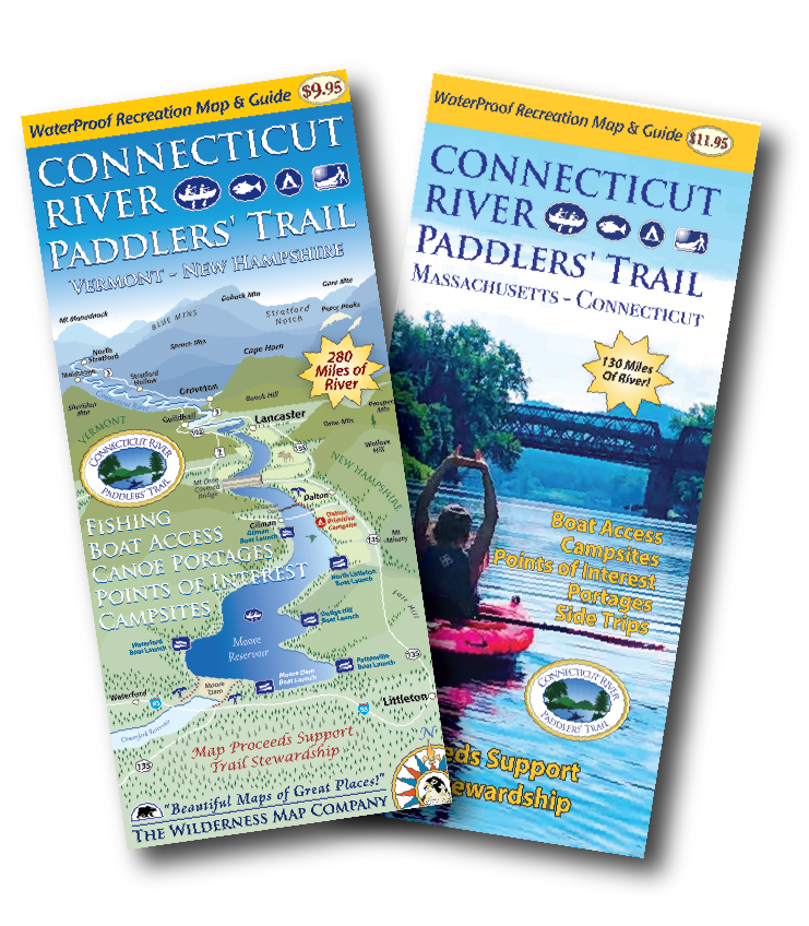
This two map set covers the Connecticut River from its headwaters south to Long Island Sound.
These two beautiful and functional maps waterproof and adventure ready. Save 10% by purchasing both at the same time!
Designed for paddlers, the maps include:
• Two waterproof, two sided maps covering 410 river miles!
• All river based recreational facilities (Access points, primitive campsites, campgrounds, portage trails, points of interest)
• Businesses of interest to visitors (outfitters, lodging establishments, convenience stores)
• Other recreational opportunities (side hikes, bike routes and paths, museums and cultural attractions)
• Natural and cultural history insights
• River mileages for access points and campsites
• Recommended river trips and their durations
Here are two glimpses at the map panels:
• VT/NH Map
• MA/CT Map
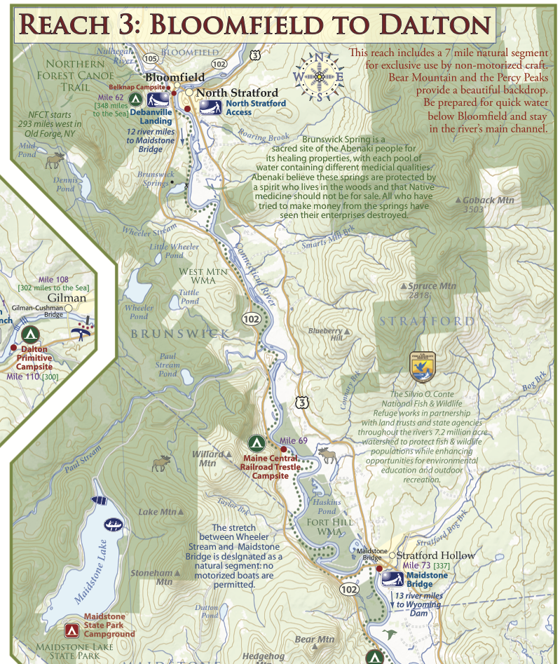
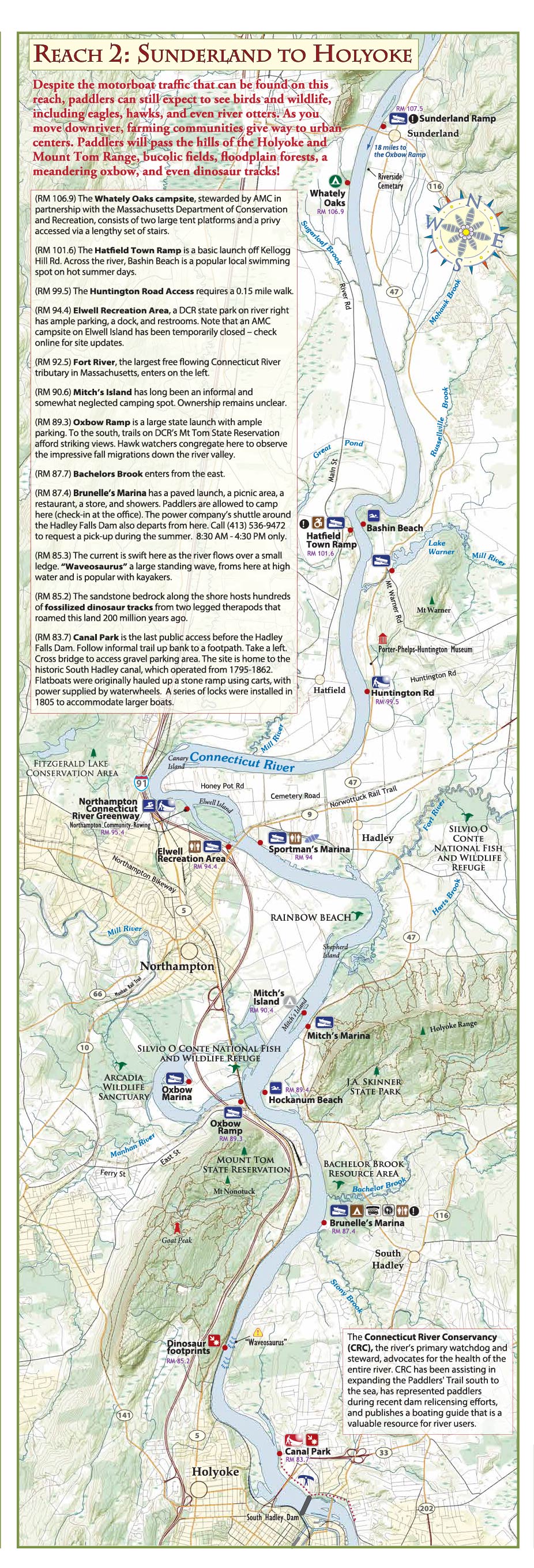
A portion of the proceeds is allocated to the Paddlers' Trail Stewardship Fund.
Order online today!
Comments
Guzzetta22
Sun, 07/07/2024 - 12:35
Permalink
New maps
New editions of maps look great. Especially love the layout and comment sections on the MA/CT section. Super helpful. So nice to have this section mapped properly....the options for maps in this section wasn't great before this one. Thank you for all your hard work.
ktparent2
Wed, 10/09/2024 - 11:49
Permalink
Something is wrong with the PayPal connection?
When I try to checkout, PayPal says:
"Something doesn’t look right. Your payment to this merchant can’t be completed using PayPal. Choose another way to pay."